No products
Product successfully added to your shopping cart
There are 0 items in your cart. There is 1 item in your cart.
 View larger

Land Premium TwoNav Software
T020058
Land Premium TwoNav Software
Land Premium is activity analysis and preparation software.
It allows you to display a multitude of maps, create routes with waypoints and analyze your outputs thanks to graphics, 3D simulations and a large range of data.
• Fast transfer of tracks to GPS
• Several types of detailed maps: topographic, road, orthophotographic, nautical, aeronautical...
• Management of a multitude of datums and coordinate systems
• Possibility to download open source maps: OpenStreetMap, Google Maps...
• Analysis of traces and measurement of the distance between 2 points on a map
• Map overlay
• Function to convert map files into desired format
• Function to calibrate paper maps in digital format
• Supported map formats: *.CDEM, *.COSM, *.CWMS, *.ECW, *.IMG, *.IMP, *.JPG, *.KML, *.KMZ, *.MAP, *.MPVF, * .OSM, *.PNG, *.RMAP, *.RTMP, *.SID, *.TIF, *.VMAP, *.WGOM
Idéal pour préparer ses sorties: randonnée, VTT, cyclisme, trail-running, kayak, quad, moto...

195 Items
In stock
- Remove this product from my favorite's list.
- Add this product to my list of favorites.
Data sheet
| Manufacturer reference | 453 |
More info
Edit tracks, routes and Waypoints with the complete Land Premium TwoNav software
Compatible track/route formats:
*.BTRK, *.FIT, *.GPX, *.IGC, *.LOG, *.KML, *.KMZ, *.PLT, *.RTE, *.TCX, *.TRK, *.TXT...
Compatible waypoint formats:
*.BWPT, *.CUP, *.GPX , *.KML, *.KMZ, *.LOC, *.TXT, *.WPT, etc.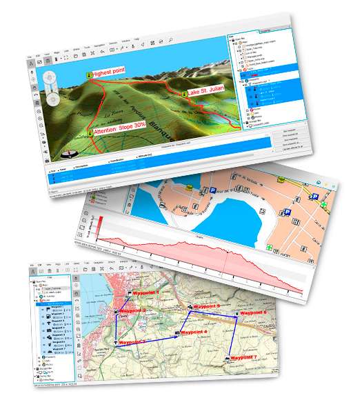
Reviews
super
super logiciel pour faire sa trace avec un accès possible à de nombreuses cartes
Accessories
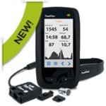
TwoNav hiking/bik...
329,90 €Anima+ hiking/bik...
399,90 €Ultra TwoNav GPS ...
299,90 €Ultra TwoNav GPS ...
305,91 €Hiking/biking GPS...
249,00 €GPS hiking/biking...
309,90 €Anima TwoNav hiki...
379,90 €GPS Bike TwoNav
349,00 €TwoNav Mountain B...
327,18 €GPS Velo Road TwoNav
335,38 €GPS Horizon TwoNav
330,65 €GPS Trail/Trail B...
364,65 €GPS Aventura/Aven...
349,30 €