No products
Product successfully added to your shopping cart
There are 0 items in your cart. There is 1 item in your cart.


GPS Montana 680 / Montana 680T Garmin
Garmin Montana 680 / Montana 680T hiking/outdoor sports GPS
Obsolete GPS from 2010, you can opt for the Montana 700 GPS by clicking on this link
Model to choose:
- Montana 680: touchscreen handheld GPS with GPS receiver and GLONASS
- Montana 680T: touchscreen portable GPS with GPS/GLONASS receiver and European leisure mapping
The Montana 680 is a portable GPS with a large color touch screen.
Designed for use on paths, roads and on the water, it is equipped with a dual GPS/GLONASS receiver for precise geolocation.
Particularity of the Montana 680t, it integrates a leisure map of Europe and an 8 megapixel camera.
• Dual orientation 65,000 color anti-glare touchscreen
• Large 4-inch screen (10.2 cm diagonal) for very good readability
• 272x480 pixel resolution
• Garmin Europe Hobby Map (Montana 680T model)
• 8 megapixel camera with automatic geotagging
• 2.7GB memory/history and possibility to add a microSD™ memory card
• 250,000 virtual treasure hunts (geocaching.com platform)
• Ability to create routes
• High-sensitivity GPS that features GPS and GLONASS satellite systems
• 3-axis tilt-compensated electronic compass
• Barometric altimeter for accurate elevation
• Hunting and fishing information, solar/lunar calendar, sunrise/sunset
• Wireless Features
• Free Mapping and Route Planning Software BaseCamp
• Free one-year subscription to the BirdsEye Satellite Imagery service
• Powered by lithium-ion battery (included) or by 3 AA batteries
• Autonomy up to 16 hours
• Robust and resistant GPS (IPX7)
Ideal for hiking, biking, off-roading and boating (can be used in the car with City Navigator maps)
Version without cartography available on request (Montana 680 model)
IGN Topo France, DOM-TOM, Mountain and European country maps available as an option
GPS Garmin USA

2786 Items
In stock
- Remove this product from my favorite's list.
- Add this product to my list of favorites.
Data sheet
| Weight | 289 g (with lithium-ion battery / 333 g (with batteries) |
| Dimension | 7,48 x 14,42 x 3,64 cm |
| Screen | 5.06 x 8.93 cm (4 inches or 10.2 cm diagonal) / transflective TFT color screen, 65,000 colors |
| Resolution | 272 x 480 pixels |
| Certificate | IPX7 |
| Instruments | high sensitivity GPS/GLONASS receiver, electronic compass |
| Battery | lithium-ion or 3 AA batteries (not included) |
| Autonomy | until 4 p.m. |
| Internal flash memory | 2,7 Go |
| MicroSD card reader | yes |
| Connection PC | USB |
| Preloaded maps | Garmin Leisure Europe (Montana 680T model) |
| Waypoints | 4000 |
| Routes | 200 |
| Tracking log | 10,000 points / 200 saved tracks |
| Manufacturer reference | 010-01534-10 / 010-01534-12 |
More info

The Garmin Montana 680 is a GPS designed for all outdoor activities.
SCREEN
The Montana 680 is equipped with a large 4-inch 65,000 color display, great in any lighting condition.
MAP
The GPS incorporates navigation functions (waypoints, route plots, etc.) and a Europe leisure map.
The microSD card reader allows the addition of advanced TOPO maps, BlueChart g2 marine charts, map data (City Navigator NT) for urban use.
Transform your "paper" maps into electronic format with the Custom Maps application and then load them into the Montana 680 GPS.
INTEGRATED CAMERA
The Montana 680 incorporates an 8 megapixel high definition camera. Take photos during your activity, each photo is automatically applied a geographical tag corresponding to the place where the photo was taken.
Photos can be displayed in landscape or portrait mode on the GPS. Using the Base Camp software, view your photos on maps.
FOLLOW-UP AND CREATION OF ACTIVITIES
The Montana 680 GPS allows you to share your activities wirelessly with other devices (routes, waypoints, treasure hunts). You can upload and share your activities for free on Garmin online tools.
The BaseCamp mapping software (free) allows you to organize and analyze your routes.
BaseCamp displays 2D/3D maps with contour lines and elevation profiles.
The GPS supports Smart Notifications (receiving emails, SMS and notifications).
POWERFUL GPS RECEIVER
Equipped with GPS and GLONASS technologies, the Montana 680 has precise GPS coordinates. The position of the device is found quickly, even in the most constrained environments (forest, deep valleys, etc.).
INTEGRATED SENSORS
The Montana 680 incorporates a 3-axis tilt-compensated electronic compass and barometric altimeter that tracks changes in atmospheric pressure to detect accurate altitude. With these sensors, you have the ability to graphically represent barometric pressure over time.
GPS RESISTANT
Robust and waterproof, the Montana 680 is resistant to shocks, dust, water and humidity (IPX7 waterproof standard).
PAPERLESS GEOCACHING
The GPS contains 250,000 treasure hunts which come from the site geocaching.com, the most important platform for virtual treasure hunts. No more manually entering coordinates, the GPS supports GPX geocaching files to download geocaches and detailed data.
AUTONOMY / POWER
The GPS has an autonomy of 16 hours. Powered by a latest generation lithium-ion battery, it can be powered directly by 3 AA batteries if necessary.
Included in this pack:
• Montana 680 or Montana 680T
• Europe leisure card (Montana 680T model)
• Li-ion battery
• USB cable
• Mains charger
• Documentation
Reviews
Garmin
Équipement fiable, très efficace et adapté aux besoins.
Toute notre équipe le recommande pour une utilisation optimale sur tous terrains.
GPS MONTANA 680T GARMIN
site efficace et rapide, GPS robuste, se connecte bien même sous un couvert végétal Amazonien
Accessories
Garmin watch/GPS ...
25,00 €Garmin Montana/Mo...
49,99 €Garmin GPS NMEA c...
49,99 €Garmin GPS motorc...
71,99 €Montana/Monterra ...
69,99 €Garmin GPS suctio...
69,99 €Garmin GPS Dash M...
89,99 €Carabiner with Ga...
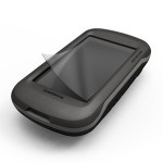
16,99 €Garmin Montana GP...
11,49 €Garmin GPS carryi...
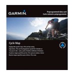
19,39 €IGN Topo France v...
134,99 €Map IGN Topo Fran...
269,99 €IGN Topo France v...
179,99 €IGN Topo Pro maps...
123,49 €Topo Maps Regions...
152,00 €Garmin City Navig...
80,99 €OSM Europe Cycle ...
44,99 €OSM US Cycle Map ...
44,99 €Garmin GPS cord
12,99 €Mains charger + G...
29,99 €Garmin Deluxe Bag
26,99 €