No products
Product successfully added to your shopping cart
There are 0 items in your cart. There is 1 item in your cart.


GPSMAP 64st / GPSMAP 64x / GPSMAP 64sx Garmin
GPSMAP 64 / GPSMAP 64s / GPSMAP 64st / GPSMAP 64x / GPSMAP 64sx Garmin Hiking GPS
Obsolete GPS from 2010, you can opt for the GPSMAP 65 by clicking on this link
Model to choose:
- GPSMAP 64: GPS portable avec récepteur GPS et GLONASS
- GPSMAP 64s: Handheld GPS with GPS/GLONASS receiver, barometric altimeter and compass
- GPSMAP 64st: GPS portable avec récepteur GPS/GLONASS, barometric altimeter and compass and preloaded cartography
- GPSMAP 64x: new generation portable GPS with GPS receiver, GLONASS and GALILEO
- GPSMAP 64sx: GPS portable nouvelle génération avec récepteur GPS/GLONASS/GALILEO, altimètre barométrique et compas
Intended for the high mountains, the GPSMAP is robust and waterproof, its interface with buttons is suitable for use with gloves or in bad weather.
The GPS is equipped with a dual GPS/GLONASS receiver with a Quad Helix antenna for fast and precise localization whatever the configuration of the terrain (dense forests, deep valleys, etc.).
Special feature of the GPSMAP 64st, it incorporates a 1/100,000th Topo Europe map and an internal memory of 8 gigas.
• Robust and resistant interface (IPX7)
• 2.6 inch anti-glare color screen
• Preloaded Garmin Topo Europe 44 countries map (GPSMAP 64st)
• 8GB internal memory and possibility to add a microSD™ memory card
• Precise GPS for high mountains that has GPS/GLONASS satellite systems and a Quad Helix antenna for better reception
• 3-axis tilt-compensated electronic compass
• Barometric altimeter (depending on version)
• Bluetooth wireless features
• Compatible with ANT+ accessories
• LiveTrack real-time tracking functionality
• Ability to create routes
• Free Mapping and Route Planning Software BaseCamp
• Free one-year subscription to the BirdsEye Satellite Imagery service
• Autonomy up to 16 hours
Ideal for high mountain hiking and multi-day treks
IGN Topo France, DOM-TOM, Mountain and European country maps available as an option
GPS Garmin USA

6946 Items
In stock
- Remove this product from my favorite's list.
- Add this product to my list of favorites.
Data sheet
| Weight | 260.1g (including batteries) |
| Dimension | 6,1 x 16 x 3,6 cm |
| Screen | 3.6 x 5.5 cm (2.6 inch) / transflective TFT color display, 65,000 colors |
| Resolution | 160 x 240 pixels |
| Certificate | IPX7 |
| Instruments | high sensitivity GPS/GLONASS receiver, Quad Helix antenna, barometric altimeter, electronic compass |
| Battery | 2 AA batteries (not included): NiMH or Lithium recommended |
| Autonomy | until 4 p.m. |
| Internal flash memory | 8 GB (with preloaded maps) |
| MicroSD card reader | Yes |
| Connection PC | USB |
| Preloaded maps | Garmin Topo Europe |
| Waypoints | 5000 |
| Routes | 200 |
| Tracking log | 10,000 points / 200 saved tracks |
| Manufacturer reference | 010-01199-21 |
More info

The GPSMAP 64st is a rugged, high-performance GPS for high mountain hiking and outdoor recreation.
Known to all practitioners for its performance, it integrates all the functions necessary for your activities:
- a Topo Europe map covering 44 countries with details of the terrain and impassable road network, forests, lakes, elevation and altitude information, points of interest
- a GPS/GLONASS technology receiver coupled to a Quad Helix antenna for precise and fast positioning
- a 3-axis electronic compass and a barometric altimeter
- notification functions (wireless) to receive information
- real-time monitoring functions
- activity analysis functions
- ...
SCREEN
The GPSMAP 64st is equipped with a highly readable 2.6-inch 65,000 color display with a resolution of 160x240 pixels. The screen has anti-glare technology.
MAP
The GPS incorporates navigation functions (waypoints, route plots, etc.) and a 1/100,000th TOPO Europe map of 44 countries. Maps can be updated for free.
The 8 gigabyte internal memory and the microSD card reader allow the addition of advanced TOPO maps, BlueChart g2 marine charts, cartographic data (City Navigator NT) for use in urban environments.
GPS is compatible with BirdsEye Select maps, raster maps can be loaded onto the device to pair with other maps.
Transform your "paper" maps into electronic format for the GPSMAP 64st!
FOLLOW-UP AND CREATION OF ACTIVITIES
The GPSMAP 64st lets you share your activities wirelessly with other devices (routes, waypoints, treasure hunts). You can upload and share your activities for free on Garmin online tools.
The BaseCamp mapping software (free) allows you to organize and analyze your routes.
BaseCamp displays 2D/3D maps with contour lines and elevation profiles.
The GPS supports Smart Notifications (receiving emails, SMS and notifications).
POWERFUL GPS RECEIVER
Equipped with GPS/GLONASS technologies and coupled with a Quad Helix antenna, the GPSMAP 64st finds your position whatever the configuration of the terrain!
INTEGRATED SENSORS
The GPSMAP 64st incorporates a 3-axis tilt-compensated electronic compass and barometric altimeter that tracks changes in atmospheric pressure to detect accurate altitude. With these sensors, you have the ability to graphically represent barometric pressure over time.
WIRELESS FEATURES
The GPSMAP 64st offers the ability to transfer its information wirelessly. Share waypoints, tracks, routes and geocaches wirelessly with other compatible devices by simply pressing "send".
The GPS is compatible with ANT+ communication technology accessories and it is possible to connect wirelessly to compatible Garmin devices, such as VIRB™ cameras and auxiliary sensors, such as Tempe™ sensors, accelerometer and heart rate monitor .
RESISTANT GPS / USE WITH GLOVES
The GPSMAP 64st has been designed to withstand the climatic conditions encountered in the high mountains.
The GPS is solid with large ergonomic keys, it is dust and water resistant (IPX7 waterproof class).
PAPERLESS GEOCACHING
GPSMAP 64st contains 250,000 geocaches from geocaching.com, the world's largest virtual geocache platform. No more manually entering coordinates, the GPS supports GPX geocaching files to download geocaches and detailed data.
AUTONOMY / POWER
The GPS can be powered by battery or by 2 AA batteries (not included), its autonomy of 16 hours allows use for a day trip.
Included in this pack:
• GPSMAP 64 / GPSMAP 64s / GPSMAP 64st / GPSMAP 64x / GPSMAP 64sx
• Garmin Topo Europe map (preloaded) - GPSMAP 64st version
• BirdsEye Satellite Imagery 1 Year Subscription
• USB cable
• Carabiner with clip
• Documentation
Manufacturer references:
- GPSMAP 64: 010-01199-00
- GPSMAP 64s: 010-01199-10
- GPSMAP 64st: 010-01199-21
- GPSMAP 64x: 010-02258-01
- GPSMAP 64sx: 010-02258-11
Reviews
GPS Garmin 65S
j'ai reçu 5 GPS Garmin 65S, tout marche bien, notre client est satisfait pour le produit. Je conseille pour l'achat. Merci
GPS de terrain
Ce GPS, facilement transportable, léger et de petit format, est parfaitement adapté aux terrains escarpés.
L'outil dont j'avais besoin
Ce GPS correspond totalement à mes attentes.
Accessories
Garmin watch/GPS ...
25,00 €Garmin NiMH Recha...
29,99 €Garmin GPS NMEA c...
49,99 €Garmin GPS car kit
49,99 €Carabiner with Ga...
16,99 €Carabiner with Ga...
19,99 €Holder with Garmi...
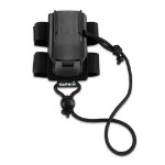
9,99 €Garmin GPS backpa...
19,99 €Garmin GPS neck s...
24,99 €Garmin GPS outdoo...
19,99 €Garmin GPS bike m...
11,99 €Garmin GPS Marine...
29,99 €Support automobil...
38,99 €Garmin GPS carryi...
19,39 €Garmin GPSMAP pro...
24,99 €IGN Topo France v...
134,99 €Map IGN Topo Fran...
269,99 €IGN Topo France v...
179,99 €Topo Maps Regions...
152,00 €Garmin City Navig...
80,99 €Garmin GPS cord
12,99 €Mains charger + G...
29,99 €Garmin Deluxe Bag
26,99 €Garmin GPS suctio...
75,99 €