No products
Product successfully added to your shopping cart
There are 0 items in your cart. There is 1 item in your cart.


GPS Cross TwoNav
Cross-GPS TwoNav
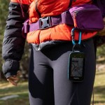
Dedicated GPS for hiking, cycling, mountain biking and adventure sports
IGN cartography of your choice (in addition to the Topo France 1:100000 map)
The Cross Twonav is a compact and resistant GPS designed to face the most difficult environmental conditions. It is resistant to shocks, water, mud and extreme temperatures.
Equipped with a protected 3.2-inch screen, navigation in the device is done using 6 buttons, 4 buttons on the sides and 2 touch screens on the front.
• Size: 110 x 63 x 21 mm - Weight: 172 g (battery included)
• 3.2" Blanview screen with Optical Bonding (sunlight readable)
• Resolution 480 x 800 pixels
• Screen protected by Gorilla Glass and capacitive multitouch (use even with gloves)
• Meets military standard MIL-STD-810
• Topographic map and OpenStreetMap world map (OSM)
• Geolocation system: GPS + Galileo + Glonass
• 32 GB / 28 GB internal memory to install your own maps
• 120 customizable data fields
• digital compass
• Altimetric barometer
• Connexion PC : USB-C (Mass storage / OTG)
• Built-in 3300mAh battery
• Buzzer and tricolor LED
• Connected GPS: ANT+/BLE sensors, Bluetooth, Wi-Fi
• Autonomy: 20 hours
• Robust, resistant to shocks, water, dust and mud: IP67
• Supported temperatures: -10°C ~ 50°C
Quicklock bike mounts (stem, handlebar, front) available as an option
Possibility to pay in 3 instalments, ask us at contact@mgaffaires.com

2865 Items
In stock
- Remove this product from my favorite's list.
- Add this product to my list of favorites.
Data sheet
| Weight | 172g (with battery) |
| Dimension | 110 x 63 x 11 mm |
| Screen | Blanview (3.2”) |
| Resolution | 480 x 800 pixels |
| Certificate | IP67 |
| GPS chip | GPS + Galileo + Glonass |
| Battery | Li-Ion 3300 mAh |
| Autonomy | 20h |
| Internal flash memory | 32 GB of which 28 GB available for data |
| Connection PC | USB type C |
| Manufacturer reference | V1081B |
More info
A multitude of functions:
- Overlay of several maps
- 3D map display
- Unlimited creation of waypoints, routes and tracks
- Download tracks and routes from online providers
- Advanced route editing
- Road navigation calculation
- Customizable profiles by sports disciplines
- Estimation of arrival times at destination
- Workouts over a certain duration, distance, heart rate and pace
- Workouts with Trackattack
- Estimation of calories burned
- Configurable alerts
- Automatic and manual laps
- Real-time altitude graph
- Customization of data pages
- Device button customization
- Retransmission and emergency message with SeeMe
- Compatibility with Geocaching and compatibility with e-Roadbooks
The key points of the GPS:
• CERTIFICATION
GPS Cross complies with the MIL-STD-810G standard, which is the most demanding for equipment dedicated to the outdoors. It is designed to be used in difficult environmental conditions: altitude, rain, humidity, freezing, thawing, dust, mud...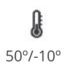
• HARDWARE FEATURES
The GPS Cross Twonav interface is made up of 6 buttons, 4 side buttons and 2 on the touch screen. The built-in lithium-ion battery guarantees 20 hours of autonomy.
• CARTOGRAPHY
- Download routes from connected providers: IGNRando, TraceGPS, LaTrace, Utagawa VTT, FFCT
- Navigation on configured routes, followed by a set of waypoints... (*.FIT, *.BTRK, *.GPX, *.KML, *.KMZ, *.PLT, *.RTE and *. TRK)
- Analysis of the course on computer
- Terrain relief highlighting: add shading to the map to more clearly show the elevation of the area being traveled
- The internal memory of the GPS allows you to store many types of maps
• REAL-TIME MONITORING AND SECURITY
With SeeMe™, broadcast your position in real time wherever you are. And in the event of an accident, send a distress message to those around you (predefined contact).
• APPLICATION SMARTPHONE TWONAV LINK
Download the TwoNav Link application and pair it with your GPS via Bluetooth, so that your activity data is automatically downloaded and you can receive notifications, messages,...
• UN GPS CONNECTÉ
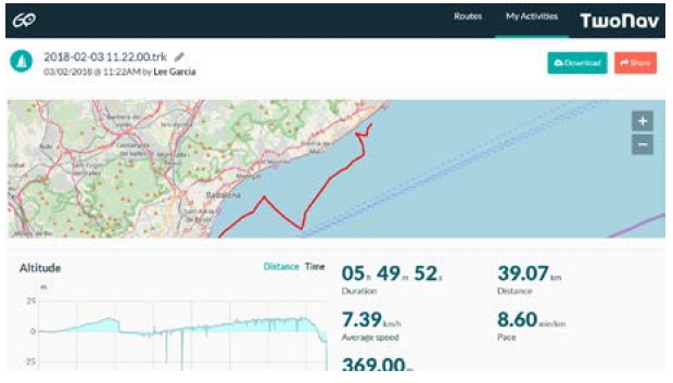
Upload your activities so they are stored and accessible wherever you are. Before setting off on an adventure, synchronize your GPS with the GO Cloud and download the route of the day.
• COMPATIBLE WITH ANT+™/BLE SENSORS
The GPS is compatible with TwoNav's own sensors (heart rate monitor belt, cadence and speed sensor), as well as with ANT+/BLE technology sensors on the market.
• TECHNOLOGY AT THE SERVICE OF TWONAV CROSS GPS
Other interesting features:
• Download free internet routes of the region you want to visit
• Mark waypoints in places you want to highlight
• Activate the deviation alarm to be notified when you deviate from your route
• Monitor 120 data fields in real time (altitude, slope, heading, coordinates, temperature....)
• Return to the starting point or calculate the shortest route home
• Mark waypoints on the map to highlight relevant locations
Included in this pack:
• All of France at 1:100,000th IGN preloaded on the internal memory
• OpenStreetMap (OSM) world map
• 3 years of SeeMe™ free
• USB type C cable for PC connection
• Application "App TwoNav Premium" (Android/iOS)
• Land Standard software (Windows/Mac) with 50% discount on the purchase of Land Premium software (full version)
• Personal space on the cloud GO TwoNav
Mapping of additional choice:
• France Topo Full (IGN - Scale 1:25.000)
• France Topo 10 departments (IGN - Scale 1:25.000)
• France Topo Zone (IGN - Scale 1:25,000)
• France Aeronautics ICAO
• Spain Topo Full (IGN - Scale 1:25.000)
• Spain Topo Zone (IGN - Scale 1:25,000)
• Spain Topo Province (IGN - Scale 1:25.000)
• Germany Topo Full (IGN - Scale 1:25.000)
• Germany Topo Zone (IGN - Scale 1:25.000)
• Germany Topo Region (IGN - Scale 1:25.000)
• Switzerland Topo Full (IGN - Scale 1:25.000)
• Switzerland Topo Zone (IGN - Scale 1:25,000)
• Italy Fraternali (IGN - Scale 1:25.000)
Accessories available:
• Carrying case
• Chest heart rate monitor belt
• Heart rate armband
• Magnetless cadence sensor
• QuickLock stem/handlebar bike mount
• Support QuickLock frontal
• Support QuickLock frontal guidon
• QuickLock bracket with RAM adapter
Reviews
Gps cross
Très bon gps pour le vtt, suite à une chute du gps c’est le 2ème très bonne carte et pour le suivi d’un parcours il est impeccable.
Je le recommande pour toutes vos sorties vtt et randonnée.
Le TOP
Possesseur d'un Anima depuis un peu plus de 5 ans que j'ai passé à mes enfants, j'ai évolué vers le Cross. Je l'ai testé en vtt, ski de rando, ski alpin, ski de fond et balade raquette. La précision est effectivement au rendez vous grâce à son système de géolocalisation GPS + Galileo + Glonass. La connectivité est appréciable. Quand à MG Affaires je n'ai pas trouvé mieux. Conseil, échange technique sur le produit, écoute du besoin. Quand au prix, même les black friday de site plus connu n'arrive à ce tarif c'est vous dire que ce site est très compétitif. MG Affaires est franchement à utiliser et à recommander. Cordialement. Lionel
trés satisfait au bout du compte
Je commence a m'habituer à l'appareil qui est très bien, j'ai eu des problèmes dessus, l’écran tactile était inactif, après quelques péripétie il m'a été remplacé, merci à MGAffaires pour leur bonne prestation.
Très bien
J'ai utilisé le modèle précédent ( Sportiva) pendant 10 ans. Les pogrès accomplis sont très importants. Ecran très clair et lisible, réactivité aux différentes aciotns, localisation et altitude précise, dernier jeu de cartes IGN à jour, identiques à GeoPortail. Il faut cependant protéger l'écran car il se raye facilement si contact avec rochers. Excellente affaire (prix et délai) sur MGaffaires.
Excellent pour les inconditionnels de l'ign
Tres bon produit. GPS sans fioritures avec une excellente visibilité d'écran qlque soit les conditions. Carte IGN 1/25000 vraiment bien qd on veut se repérer a autre chose que des chemins vectoriels. Autonomie d'une journée ok (6h a 21h en velo en éteignant l'écran pdt les pauses sans le Bluetooth). Chargement via batterie sup ok. Site Mgaffaire au meilleur prix. Livraison rapide. Contact tel ok et personne accueillante. Je recommande.
GPS Cross
GPS de bonne facture comme tjrs chez TwoNav.
L'avenir nous dira si la batterie intégrée de 3600mA tiendra ses promesses!
cross
Utilisé depuis quelques mois, bon produit. point fort: lisibilité, cartes IGN et autonomie.
Petit défaut: bouton marche arrêt pas toujours facile à utiliser. Je recommande.
Très bon appareil
Acheté avec une carte France 1/25000, ce GPS est vraiment un super outil pour s'orienter, suivre un parcours. Il faut prendre le temps de l'apprivoiser mais sincèrement c'est un appareil vraiment fiable et complet pour un prix raisonnable.
Grande satisfaction
Appareil répondant parfaitement à mes attentes, complet sans être trop compliqué à utiliser. Expédition rapide.
Accessories
IGN Top25 Map Two...
39,90 €IGN Top25 Map Reg...
109,90 €IGN Top25 map of ...
239,92 €ANT+ TwoNav Heart...
39,00 €Magnetless TwoNav...
35,00 €TwoNav Heart Rate...
59,00 €TwoNav Bike Stem/...
19,00 €Support QuickLock...
29,00 €TwoNav Raised Qui...
29,00 €Support QuickLock...
29,00 €Support QuickLock...
29,00 €Adjustable TwoNav...
4,50 €TwoNav GPS elasti...
7,50 €TwoNav GPS retrac...
19,00 €TwoNav GPS carabi...
24,00 €TwoNav GPS backpa...
34,00 €Cross TwoNav GPS ...
29,00 €TwoNav USB-USB C ...
7,00 €